Share Shaping Whitsunday Walking Trails on FacebookShare Shaping Whitsunday Walking Trails on X (formerly Twitter)Share Shaping Whitsunday Walking Trails on LinkedinEmail Shaping Whitsunday Walking Trails link
Consultation has concluded
Consultation results and next steps
We thank the community for having their say on the region's walking trail network.
Walking trails are a popular recreational asset for residents of the Whitsundays who seek environmental enjoyment and fitness. We sought feedback on our mainland walking trail network to understand the public’s perception of and demand for upgraded or expanded walking trails in the region.
A strong demand for more trail management of existing mainland and island tracks, including managing slippery eroded surfaces and clearing overgrown grass, trees, weeds and invasive plants.
Strong support for additional trails of varying lengths and difficulties at various locations across the region that include attractions, such as water holes, beaches and outlooks/views.
Additional signage with information is needed at the start of and on the trails as well as signage across the region to locate trail heads.
Desire for upgrades to existing tracks including,
lengthening or creating more loops and connecting tracks
adding amenities, such as bins, pack racks, toilets, seats and water stations.
Upgrades to improve safety of trails shared between mountain bikes and walkers
Challenges for mountain bikers and trail walkers to co-exist on trails. Whilst 51% identified they may co-exist, majority of persons supportive of co-existence suggested specific rules and track design for it to work safely, such as signage, speed limits and track widening in areas of low visibility or hazardous sections.
Whilst majority acknowledge mountain bikers and trail walkers can share trails, there is strong desire for some designated mountain bike tracks for users that may ride too competitively for safe shared tracks. Designated tracks may be extensions that lead off existing trails or unlocking trails in new areas.
Council Officers will consider the consultation report when developing Whitsunday Mainland Camping and Walking Trails and deciding upon future priorities for our trail network.
Are you passionate about hiking and discovering our stunning natural landscapes?
We are assessing our Whitsunday Region's mainland walking trail network to understand the public’s perception of and demand for upgraded or expanded walking trails in the Region. Our natural assets are a strength of our Region, and we are eager to understand if they meet the needs of residents and visitors.
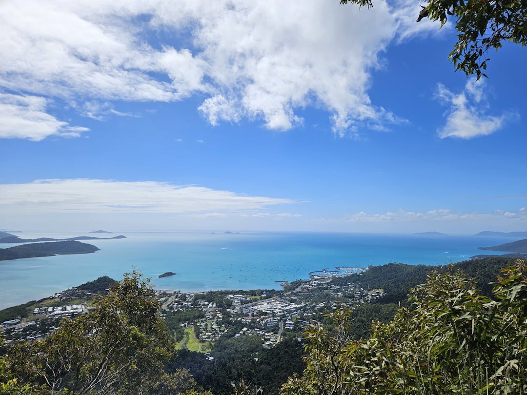
Currently, there are 19 mainland trails in Whitsundays, of varying length, difficulty and habitats. Not all are within bushland environments. View our fact sheet for more information.
Airlie Beach Surrounds (10)
Airlie Creek Track
1.7km return
Bicentennial Boardwalk
8km return
Honeyeater Lookout
8.2km return
Whitsunday Great Walk
27.1km
Coral Beach Walk
4.2km return
Mt Rooper Trail Circuit
5.4km
Mt Rooper - Swamp Bay
4.2km
Wompoo Way
7km return
Coastal Fringe Circuit
3.2km
Kingfisher Walk
2km return
Bowen (7)
Cape Edgecumbe Trail
5km return
Kings Beach Walk
1.8km
Queens Bay Beach Walk
1.6km
Mullers Lagoon
2.3km
Hanson Park to Horseshoe Bay
2.6km
Rose Bay Sandhills
1km
Flagstaff Hill Tracks
1.5km
Other (2)
Hydeaway Bay Loop
2.1km
Collinsville - Scottville
3.5km
Have your say on the type of and demand for walking trails via a short survey below.
Consultation results and next steps
We thank the community for having their say on the region's walking trail network.
Walking trails are a popular recreational asset for residents of the Whitsundays who seek environmental enjoyment and fitness. We sought feedback on our mainland walking trail network to understand the public’s perception of and demand for upgraded or expanded walking trails in the region.
A strong demand for more trail management of existing mainland and island tracks, including managing slippery eroded surfaces and clearing overgrown grass, trees, weeds and invasive plants.
Strong support for additional trails of varying lengths and difficulties at various locations across the region that include attractions, such as water holes, beaches and outlooks/views.
Additional signage with information is needed at the start of and on the trails as well as signage across the region to locate trail heads.
Desire for upgrades to existing tracks including,
lengthening or creating more loops and connecting tracks
adding amenities, such as bins, pack racks, toilets, seats and water stations.
Upgrades to improve safety of trails shared between mountain bikes and walkers
Challenges for mountain bikers and trail walkers to co-exist on trails. Whilst 51% identified they may co-exist, majority of persons supportive of co-existence suggested specific rules and track design for it to work safely, such as signage, speed limits and track widening in areas of low visibility or hazardous sections.
Whilst majority acknowledge mountain bikers and trail walkers can share trails, there is strong desire for some designated mountain bike tracks for users that may ride too competitively for safe shared tracks. Designated tracks may be extensions that lead off existing trails or unlocking trails in new areas.
Council Officers will consider the consultation report when developing Whitsunday Mainland Camping and Walking Trails and deciding upon future priorities for our trail network.
Are you passionate about hiking and discovering our stunning natural landscapes?
We are assessing our Whitsunday Region's mainland walking trail network to understand the public’s perception of and demand for upgraded or expanded walking trails in the Region. Our natural assets are a strength of our Region, and we are eager to understand if they meet the needs of residents and visitors.
Currently, there are 19 mainland trails in Whitsundays, of varying length, difficulty and habitats. Not all are within bushland environments. View our fact sheet for more information.
Airlie Beach Surrounds (10)
Airlie Creek Track
1.7km return
Bicentennial Boardwalk
8km return
Honeyeater Lookout
8.2km return
Whitsunday Great Walk
27.1km
Coral Beach Walk
4.2km return
Mt Rooper Trail Circuit
5.4km
Mt Rooper - Swamp Bay
4.2km
Wompoo Way
7km return
Coastal Fringe Circuit
3.2km
Kingfisher Walk
2km return
Bowen (7)
Cape Edgecumbe Trail
5km return
Kings Beach Walk
1.8km
Queens Bay Beach Walk
1.6km
Mullers Lagoon
2.3km
Hanson Park to Horseshoe Bay
2.6km
Rose Bay Sandhills
1km
Flagstaff Hill Tracks
1.5km
Other (2)
Hydeaway Bay Loop
2.1km
Collinsville - Scottville
3.5km
Have your say on the type of and demand for walking trails via a short survey below.
Shaping Whitsunday Walking Trails has finished this stage
This consultation is open for contributions.
Under Review
Shaping Whitsunday Walking Trails has finished this stage
Contributions to this consultation are closed for evaluation and review. The project team will report back on key outcomes.
Final report
Shaping Whitsunday Walking Trails is currently at this stage
The final outcomes of the consultation are documented here. This may include a summary of all contributions collected as well as recommendations for future action.